We ship worldwide.
All shipping is charged at cost.
Ask us about combined shipping for more than one item.
| Shopify Unique ID: | 10561234665764 |
| Trademe Reference: | PR25 (222) |
| Category: |
Maps / Charts / Atlas |
| New / Used: | Used |
Description
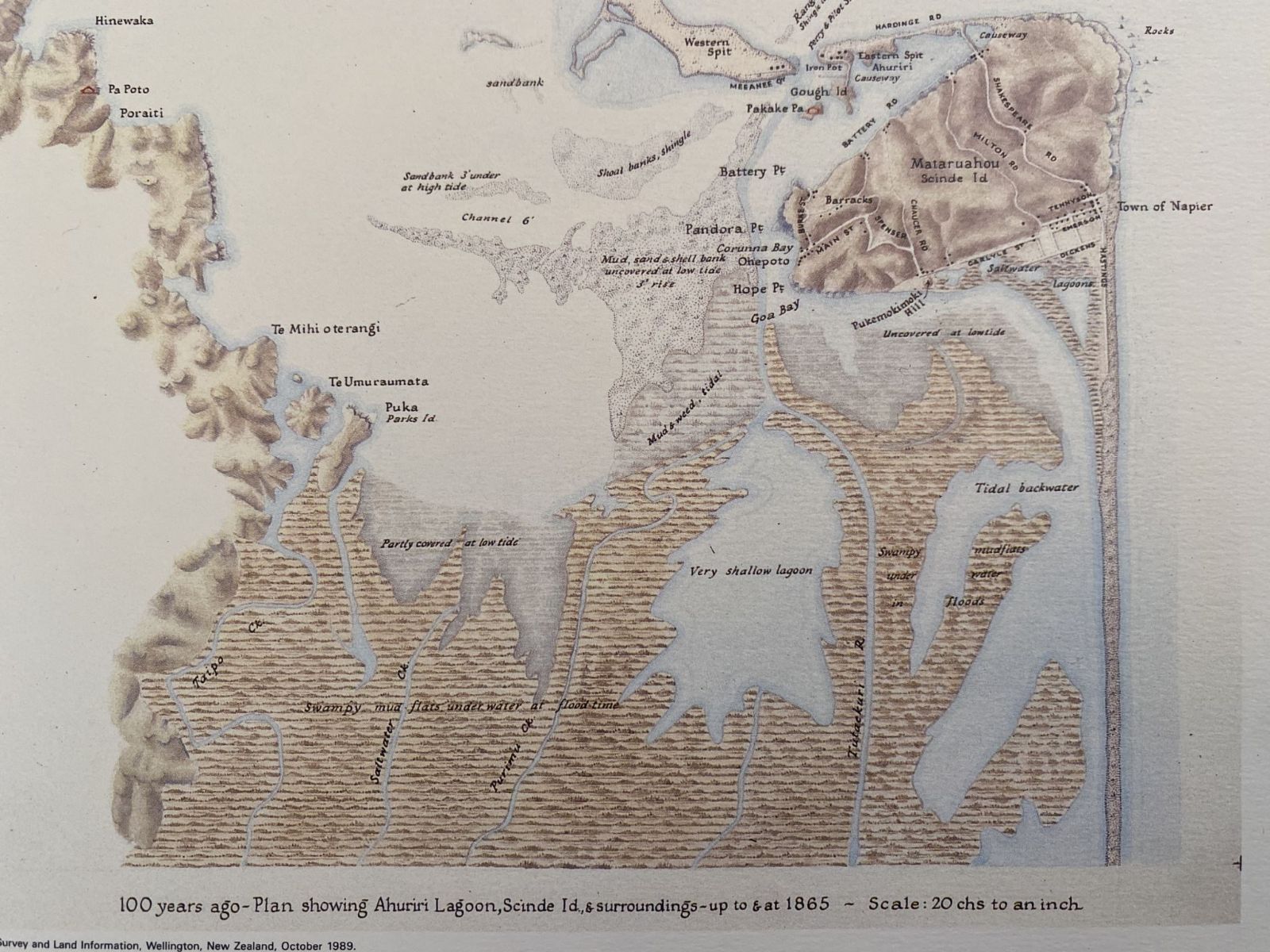
VINTAGE MAP: Napier pre and post earthquake 1865 and 1965
DESCRIPTION
Format: medium photolithograph
Published: Napier City Council 1965, reprinted 1989
Size (mm): 420 w x 300 h
SKU: A3M/2310/Nmaps2
ABOUT
Own a unique piece of New Zealand history that would look fantastic framed.
This map is a 1989 reproduction from decades ago by the Department of Lands and Survey Information of two original copies held at the Napier City Council
Plan of Napier City in 1865, comparing;
> Ahuriri Lagoon, Scinde Island and surrounds up to 1865.
> 100 years of progress 1965 after reclamations and earthquake action.
Our vintage posters/maps are 100% authentic and they range across various decades. Whilst many of our items like this end up in museums, they are also popular for bringing a touch of nostalgia to the home as well as offices, meeting rooms and waiting rooms of the locations / services / industries that they are related.
CONDITION
As new
REMARKS
Scarce
See our other vintage maps/posters.
Will be shipped flat in a large A3 sized cardboard mailer.
LEADING VINTAGE BOOKSHOP SINCE 1989
Books - Newspapers - Magazines - Posters - Maps - Ephemera
ENQUIRES
- All enquires and questions welcome
SHIPPING
- All shipping is via tracked courier
- We do not risk letter post
- Incorrect shipping option will cause delay
- Ensure your delivery address is secure
- PO Box address for New Zealand only
- International must be a street address
- Shipping charges are driven by weight, not volume.
- Combined shipping must be setup prior on request, no manual refunds post sale.
BUY WITH CONFIDENCE
- Only quality products, listings, images
- Our feedback speaks for itself
- Only eco-packaging, no plastic
- Bank deposit on request
- Prompt shipping across New Zealand
- We also ship to customers across 42 countries
BOOK DESCRIPTIONS
- Book description definitions explained via the About/Condition & Descriptions page.
Listing format © 1989-2026 Unicorn Books Ltd